
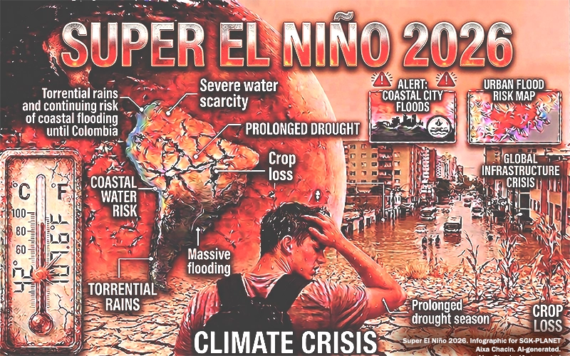
Before we learn about the Super El Niño 2026, what do we call the El Niño phenomenon?
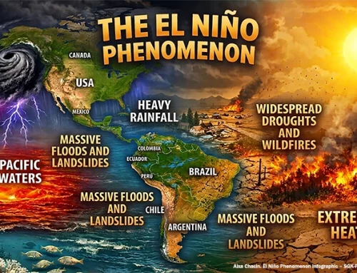
El Niño is the warm phase of a natural climate cycle known as the El Niño-Southern Oscillation (ENSO). It is characterized by the anomalous warming of surface waters in the tropical Pacific, which alters atmospheric circulation and modifies rainfall and temperature patterns across much of the planet (NOAA).
When the phenomenon turns into a Super El Niño
There are varying degrees of intensity for the ENSO phenomenon. When it intensifies and exhibits exceptional characteristics, it is informally known as a “Super El Niño.” The term applies when the surface temperature of the tropical Pacific Ocean exceeds 2 °C above the average and can reach up to 3.4 °C above the average.
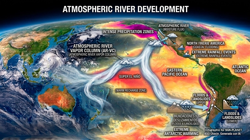
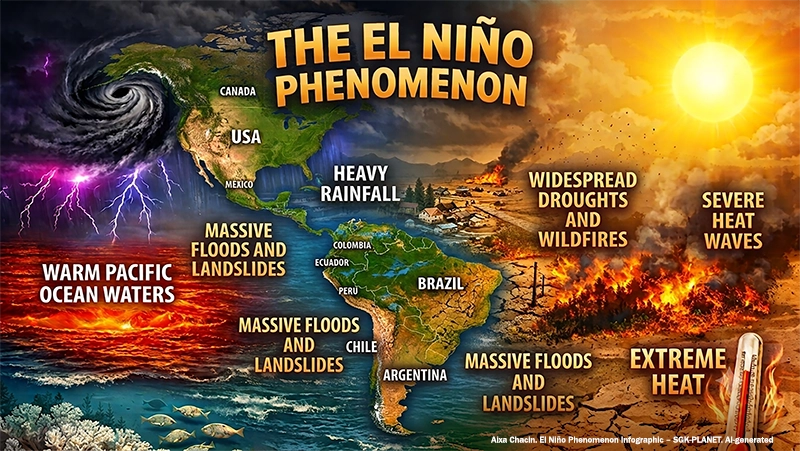
At higher levels, the heat transferred from the ocean to the atmosphere shifts currents in both hemispheres into unusual configurations, triggering simultaneous yet opposing events—such as droughts, floods, fires, and disease outbreaks—in regions far apart.
Why forecasts are already pointing to a Super El Niño in 2026
Since record-keeping began—and with modern technologies to measure these events—only three major Super El Niño events are known to have occurred: 1982–83, 1997–98, and 2015–16.
According to the latest bulletin from the World Meteorological Organization (WMO), El Niño/La Niña Today, issued on September 3, 2026, the 2026 El Niño phenomenon has “consolidated”. It is expected to intensify over the next few months and become a very strong event.
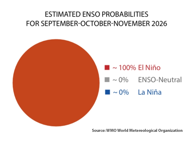
As evidenced by WMO forecasts, the probability of El Niño persisting through February 2027 is extremely high, practically 100%. This is the first time an El Niño/La Niña Today bulletin has been “so categorical,” demonstrating the strong consensus among WMO experts.
All conditions favor the appearance of the Super El Niño 2026
These unusually warm oceanic conditions in the tropical Pacific will continue to strengthen the 2026 El Niño over the coming months. It will intensify significantly before peaking late in the year and maintain its extreme climatic effects through the Northern Hemisphere spring of 2027.
Subsurface ocean temperatures are also exceptionally high, exceeding normal levels by more than eight degrees Celsius during July and early August. This creates a massive mass of very warm ocean water that will intensify El Niño.
The WMO update indicates that El Niño has strengthened and will remain very intense—or even exceptionally intense—in the coming months. If it continues to develop as forecast, it could be the strongest since monitoring began, surpassing levels reached over the past four decades.
According to models from the European Center (ECMWF), NOAA’s CFS, and the World Meteorological Organization (WMO), ENSO anomalies approaching +3°C are projected for late 2026. If these forecasts materialize, the event could potentially be the most intense on record since 1877–78.
Impacts of the Super El Niño 2026 for Latin America and the Caribbean
All of this is taking place on a hotter planet. El Niño is not “the visible face of climate change” (SGK-PLANET, July 24, 2025). However, climate change amplifies it by combining it with already record-breaking ocean temperatures, which could push the global average temperature to unprecedented levels in 2026 or 2027.
By 2026, heat and drought will prevail across Central America, the Caribbean, northern Colombia, and Venezuela, with a severe water deficit in the Central American Dry Corridor. In contrast, heavy rains and flooding are projected for the Pacific coasts of Ecuador and Peru, central Chile, southern Brazil, Uruguay, Paraguay, and northern Argentina.
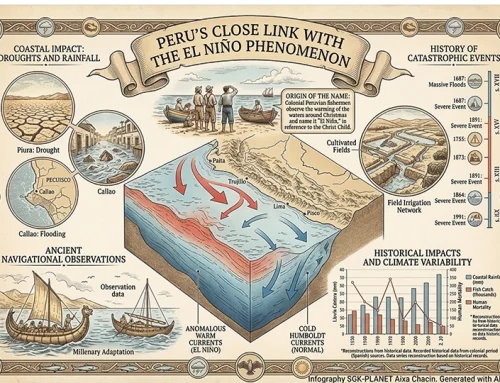
Recorded figures from previous years show that the Super El Niño of 1982-83 caused more than 1,600 deaths and $3.6 billion in losses in South America. The 2014–16 event—occurring when warning systems had improved—saw the death toll drop to 460, yet it caused $2 billion in damages.
The events in Panama in August 2023 illustrate the magnitude of the risks. Water levels in the lakes feeding the Canal dropped, forcing restrictions on vessel traffic and resulting in global economic consequences. During the 1997 event alone, the region’s transport sector incurred losses totaling $1.7 billion.
Physical effects that translate into concrete risks
Food security: droughts and floods affect agricultural production—where the vast majority of losses occur—and put upward pressure on food prices.
Energy: reduced rainfall impacts hydroelectric systems, upon which a significant portion of the regional energy mix depends.
Public health: heat and rainfall variability alter conditions that favor vectors such as the mosquitoes that transmit dengue and chikungunya.
Critical infrastructure: roads, bridges, power grids, and ports are exposed to landslides, flooding, and prolonged disruptions.
How can LAC countries prepare themselves?
Unlike other catastrophic events such as hurricanes or earthquakes, El Niño can be predicted months in advance. This allows for the early implementation of preventive practices based on clear priorities:
- Activate protection mechanisms in advance: Early Action Protocols and Emergency Funds for Disaster Response.
- Strengthen early warning systems and hydrometeorological monitoring.
- Carry out preventive works: cleaning drains and watercourses, reinforcing levees, stabilizing slopes, maintaining roads, and protecting hospitals, schools, and electrical grids.
- Protect productive sectors: agroclimatic insurance, contingency funds, strategic food storage, distribution of drought-resistant seeds, and direct support for small-scale producers.
- Adapt infrastructure: drainage systems designed for climate variability, resilient materials, and climate-adaptive road infrastructure.
- Coordinate regionally: exchange of climate information, joint protocols, and mechanisms for logistical and health cooperation.
What we really need to ask the bodies responsible for implementing these contingency plans—in the face of catastrophic events like the 2026 Super El Niño—is how quickly we can act, because we are already running late.
Sandor Alejandro Gerendas-Kiss
Editor of SGK-PLANET
Sources consulted
WMO. World Meteorological Organization. (2026, agosto). El Niño set to become very strong, raising risks of extreme weather into 2027. https://wmo.int/news/media-centre/el-nino-set-become-very-strong-raising-risks-of-extreme-weather-2027
NOAA National Centers for Environmental Information. (2026, August) Monthly Global Climate Report for July 2026. Retrieved on September 10, 2026, from https://www.ncei.noaa.gov/access/monitoring/monthly-report/global/202607/understanding-global-temperature-departures-and-enso. DOI: https://www.ncei.noaa.gov/access/metadata/landing-page/bin/iso?id=gov.noaa.ncdc:C00672
Soulo, Celeste. Secretary-General, WMO. World Meteorological Organization. (2026, September 3). An exceptional El Niño demands an exceptional response. https://wmo.int/secretariat/celeste-saulo/exceptional-el-nino-demands-exceptional-response
Stockdale, Tim. Centro Europeo (ECMWF). (2026, April 10). How confident should we be in a prediction of El Niño? https://www.ecmwf.int/en/about/media-centre/science-blog/2026/el-nino-2026



Leave A Comment