Source:
Magazine all about Hurricanes
Hurricanes, winds that cause great damage
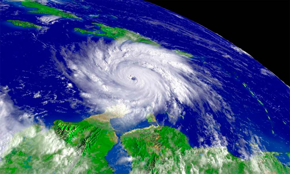
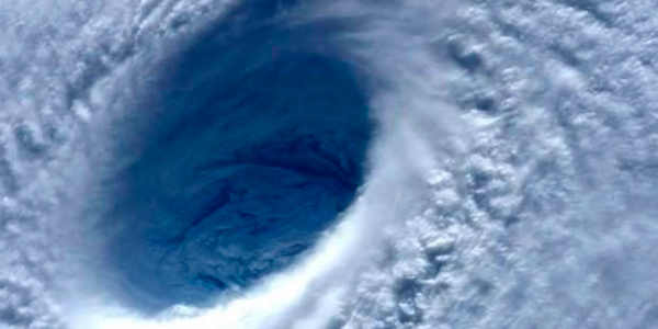
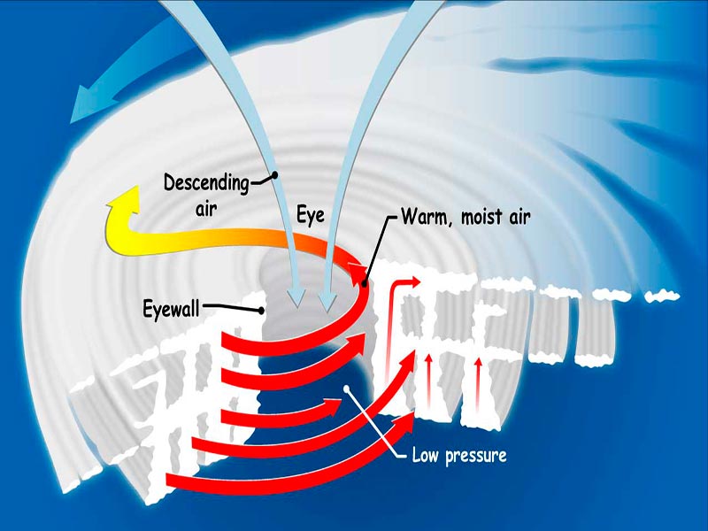
In the most of cases, a hurricane originates in the tropics and from there it begins to expand its diameter and speed. These cyclones begin when a series of electrical storms move over warm waters. The hot air combines with the heat from the surface of the ocean and begins to rise, which produces a low pressure on the sea surface. Over time a tropical depression can turn into a tropical storm and finally in a hurricane. The part that distinguishes the hurricane is the eye, a center of calm winds, surrounded by a wall of intense winds and storms that produce large bands of precipitation. The place of arrival of the hurricanes is very variable, but the 85% starts is in an area near the African island of Cape Verde. To establish the speed of a hurricane, “hurricane-hunting” planes are used, which by means of a risky maneuver are introduced into the eye to obtain the measurements.
What are cyclones?
They are winds that turn at different speeds, accompanied by storms. So a tropical depression, a tropical storm, a hurricane, a typhoon or a tornado are classified as cyclones.
Source: NASA
What is the challenge of hurricane hunters aircraft?
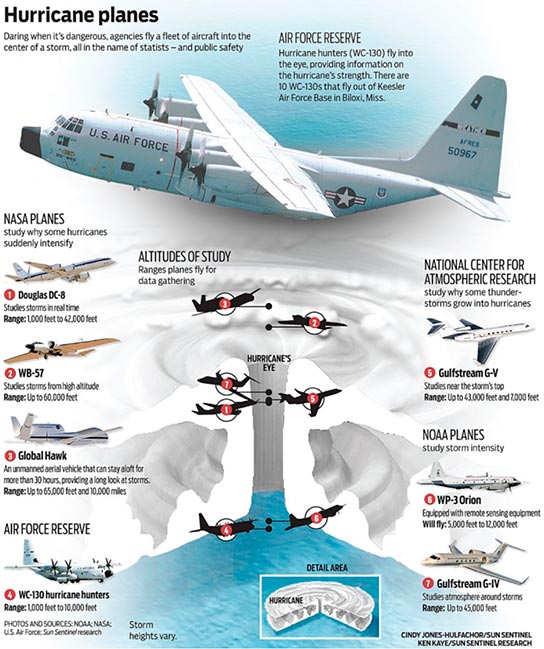
To establish the speed of a hurricane, “hurricane-hunting” planes are used, which flies inside the eye of the hurricane and release small probes inside. Some devices have flight autonomy greater than 28 hours and can rise up to 18 km in height, from where they descend to the eye of the storm to release these devices to measure the speed of the hurricane.
Fly With Hurricane Hunters as
They Measure the Power of a Storm
How
born a
hurricane?
I. Tropical depression 39- mph
II. Tropical storm 40 to 73 mph
III. Hurricane 74+ mph

Composición: SGK-Planet
Will there be a category 6 for hurricanes?
At the beginning of 2018, appeared in several media a news reporting that the scientific community is discussing adding category 6 to the Saffir-Simpson scale. According to some scientists, the current scale does not reflect the increase in the intensity, power and duration of some global cyclones. During a conference in New Zealand, the specialists considered the idea of adding category six to the current scale, also foreseeing an increase in the severity of tropical cyclones due to the oceans warming and climate change. The proposition of category 6 has not yet been accepted because some scientists are opposed to it, arguing that it would rather complicate the simplicity and understanding of the issue.
Is there any connection between hurricanes and global warming?
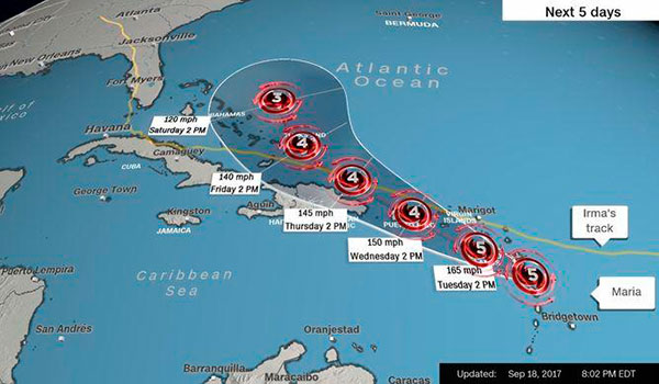
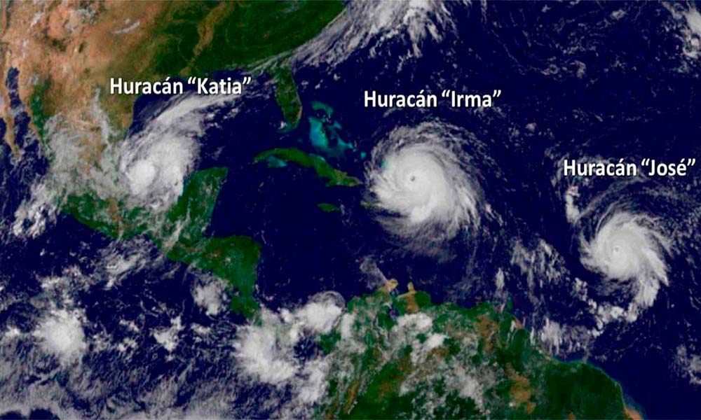
There is no evidence on a relationship between hurricanes and global warming. So far, no evidence has been found to support this relationship. Every time an extraordinary phenomenon occurs that is thought to be related to climate change, some precedent comes to light, often happened 50, 100 or more years ago, when global warming, the main factor of climate modification, was not a issue. However, with Hurricane Irma (Sep-2017), a novel event occurred. For the first time a cyclone acquired category 5 in the Atlantic Ocean, before reaching the Caribbean. As if this were not enough, the phenomenon was repeated the same month with Hurricane Maria. This pair of category 5 hurricanes in the Atlantic is unprecedented and has raised suspicions about global warming and its relationship to intensify cyclonic systems.
Something unprecedented happened with two hurricanes
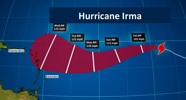
Source: Telemundo.com
Irma reaches category 5 for the 1st time in Atlantic
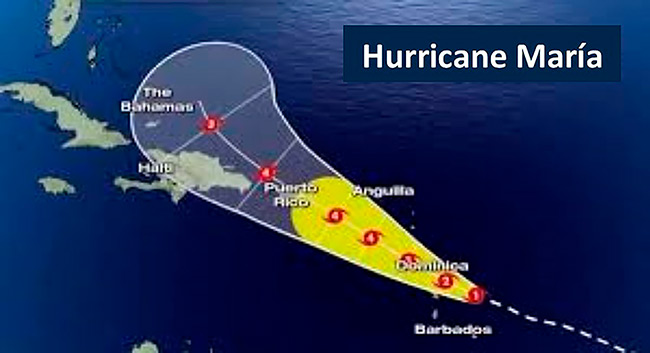
Source: Youtube.com
In the same month with Maria repeats the story
The first narrated hurricane

Source: Amino Apps
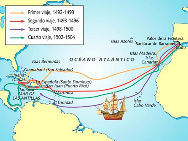
Christopher Columbus, in the eventful return of his first trip, in which he suffered two weeks of severe storms and serious dangers. Columbus describes in the newspaper on board that, on Monday, February 18, 1493, at dawn, they were able to approach the island of Santa María de las Azores. He sent for the last anchor he had left and sent a boat to land. When their sailors made contact with the people, they told them that they had never seen such a storm as the last fifteen days, and were amazed at how the caravel “La Niña” had escaped irremediable collapse.

Tropical Disturbance > Tropical Depression > Tropical Storm > Hurricane

In general, a hurricane originates in the tropics and from there it begins to expand its diameter and speed. These cyclones begin when a series of electrical storms travel over warm waters. The hot air combines with the heat of the ocean’s surface and begins to rise. Which produces a low pressure on the marine surface.
The winds that circulate in opposite directions make the storm begin to turn. The rise of warm air affects the high pressure in the high areas of the atmosphere, causing the pressure to decrease. The air rises faster and faster, attracts more warm air from the surface of the sea and absorbs more cold and dry air from above, pushing it down. In its desplacement over the water it is nourished by a greater amount of humidity and heat, increasing its speed.
Over time the tropical depression turns into a tropical storm and finally a hurricane, whose visible signal is the eye, a center of calm winds, surrounded by a wall of intense winds and storms that produce large bands of precipitation.
Tropical Depression
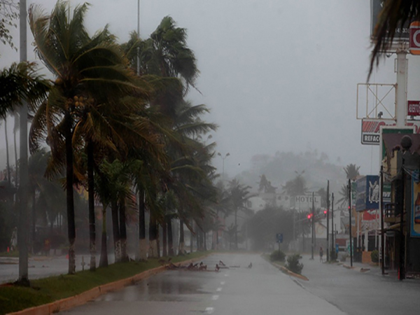
Source: Organización Radiofónica de Oaxaca
It is a tropical cyclone with sustained surface winds less than 63 kph (39 mph). It is formed when an area of low pressure is accompanied by thunderstorms that produce a circular wind flow.
Tropical Storm
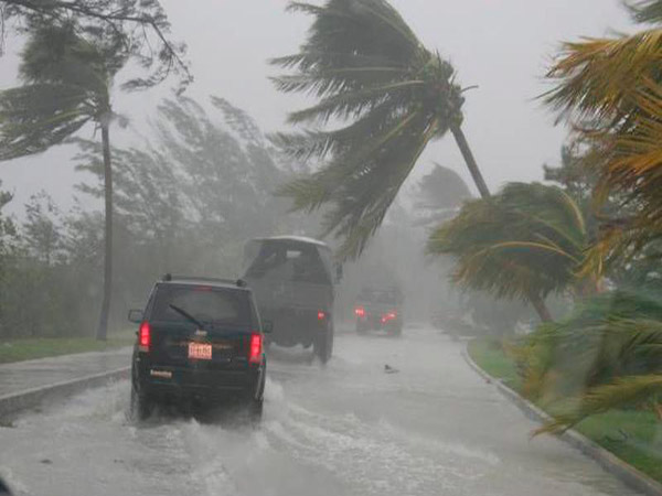
Source: spice.com
It occurs when the tropical depression becomes more organized and the maximum sustained winds acquire gusts between 63 kph (39 mph) and 118 kph (73 mph). This last speed is the previous step so that it becomes a hurricane.
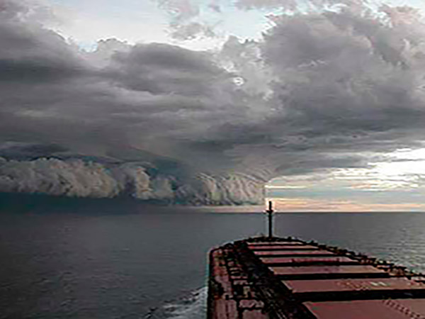
Hurricane
Source: Youtube.com
To move to the hurricane category the tropical storm must develop a speed of at least 119 kph or 74 mph. At that moment the eye and its other characteristics are formed and continuing the path initiated by the depression.
Source: NASA
Hurricanes: what they are and how they form
* Being well informed will give you advantages
* You can prepare yourself better
* It will facilitate your decision making
* You can control your level of anxiety
* You will know what should be done before your arrival
* You will be ready for the following days
Preventions for before, during and after hurricanes
Note: At the end of the Magazine, you will find a list of “Preventions for before, during and after the hurricanes”. It is very important to consider it, especially if you are in an area under the threat of a storm or hurricane.
Are we facing a wake-up call from Mother Earth?
The natural phenomenon of cyclones has been repeated year after year under a more or less stable pattern. This regularity is observed and measured for decades. What can we think when the pattern of behavior breaks? This happened twice in 2017. Should not this be seen as a sign of climate change? Because it is undoubtedly a major change in the hurricane cycle, a cycle related to climate.
Irma and Maria two hurricanes
that got out of the script
Irma

Source: The Weather Channel
Maria
Source: entérandoteymas.com
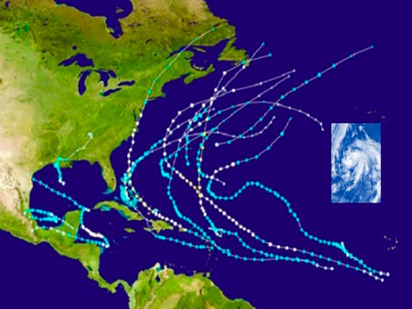
Cape Verde, the incubator of cyclones
Composition: SGK-PLANET
The place of arrival of the hurricanes is very
variable, but 85% of the time start is in an area
near the African island of Cape Verde
Composition: SGK-PLANET
The routes of Christopher Columbus
and its similarity to those that follow
the hurricanes
Differences between hurricanes, typhoons and tornadoes
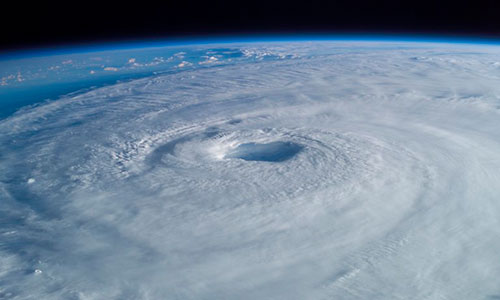
Hurricanes
Source: Nasa
It is the name given to these cyclones in the Atlantic.
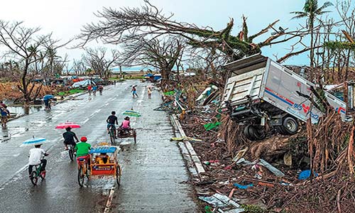
Typhoons
Source: Real World Survivor/Tifón Yolanda
It’s similar to the hurricane, but that’s the name in the Pacific.
Tornadoes
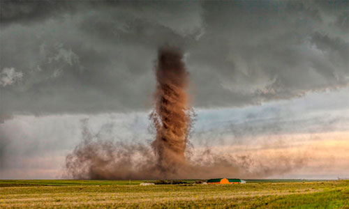
Source: Passenger6a.es
High speed air mass whose lower end is in contact with the ground.
How the names of hurricanes are chosen
Source: Info7.mx
At the beginning of the 19th century, hurricanes were named according to the name of the saint of the day when the cyclone manifested its greatest devastation. At the end of the 19th century, the Australian meteorologist Clement Wragge named one of these storms with a feminine name, although retaining only biblical names. In 1953, in the United States, they decided to choose any name but always as a woman. In 1979 the World Meteorological Organization and the Meteorological Service of the United States, to avoid problems with feminists, decided to alternate female and male names and thus ended the sexist polemic. Since then every year a list is prepared, which is repeated every six years, in alphabetical order, starting each year with the letter “A”. So, we could have: Alejandro, Betty, Carlos, Danielle, etc. Finally, there is an agreement to exclude the names of catastrophic cyclones, those that have caused great mortality and devastation.
Hurricane names 2024
Andrea
Barry
Chantal
Dexter
Erin
Fernand
Gabrielle
Humberto
Imelda
Jerry
Karen
Lorenzo
Melissa
Nestor
Olga
Pablo
Rebeca
Sebastien
Tania
Van
Wendy
Why do hurricanes have names?
Three devastating hurricanes
Mitch / Oct – Nov 1998

Source: LaPrensa.hn
Hurricane Mitch
Mitch toured Central America between October 22 and November 5, 1998. He became Category 5 and the worst of the twentieth century. Mitch left record amounts of rainfall in Honduras and Nicaragua, with more than 19,000 dead and nearly 8,000 missing.
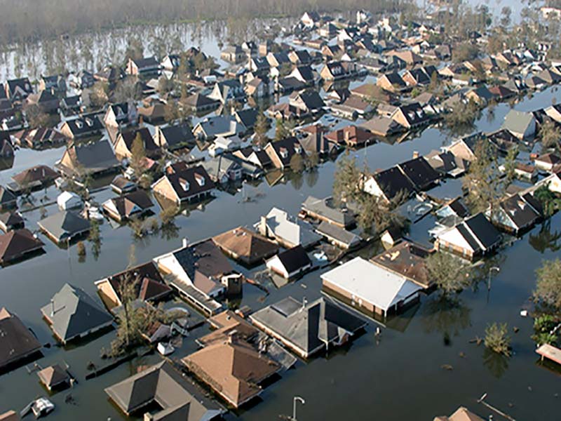
Katrina / Aug – Sep 2005
Soursce: Antena 3
Hurricane Katrina
Hurricane Katrina arrived in New Orleans where it gained maximum strength on August 29, 2005, with winds of more than 155 mph per hour along the Gulf Coast of the United States. It claimed the lives of about 1,800 people, a million displaced people and more than a million damaged houses. It is considered the most expensive natural catastrophe in the history of North America with damages of 108 billion dollars.
Jeanne / Sep 2004

Source: blog.fundacionmontemadrid.es
Hurricane Jeanne
Jeanne affected the Virgin Islands, Puerto Rico and the Dominican Republic in September 2004 and reached the coast of Florida, as the fourth hurricane that hit the peninsula that year. It left 3,000 dead and more than 300,000 victims in Haiti.
Top 10 Most
Destructive Storms
to Ever Hit
Planet Earth
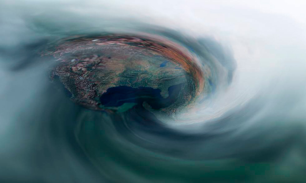
Is someone watching us through the great eye of the hurricane?
Source: El País
Preventions for before, during and after hurricanes
Official hurricane season:
Starts on June 1 of each year / Ends on November 30
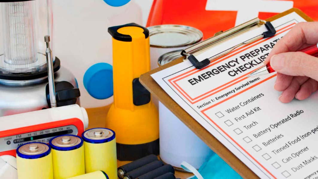
BEFORE THE STORM OR HURRICANE ARRIVES
-
Determine the evacuation routes.
-
Identify the official places of refuge.
-
Check your emergency equipment, such as flashlights, generators, and battery-operated equipment, such as cell phones and your NOAA All Hazards Radio.
-
Buy non-perishable food and clean water.
-
Buy wooden panels or other material to protect your home.
-
Prune the trees and shrubs so that the branches do not fly towards your house.
-
Clean clogged rain gutters and drains.
-
Decide where to move your boat.
-
Check your insurance policy.
-
Find hotels that accept pets on their evacuation route.
IF YOU LOCATED IN AREA UNDER WARNING
OF STORM OR HURRICANE
-
Frequently listen to the radio, TV or NOAA All Hazards Radio for official bulletins about the course of the storm. (Digital media, social networks, etc.)
-
Fill the gas tank and inspect your vehicle.
-
Inspect and make sure your mobile home is well anchored to the ground, but DO NOT stay in a mobile home or prefabricated house.
-
Make sure you have extra cash on hand.
-
Prepare to cover all windows and doors with panels or other protective materials.
-
Check batteries and store canned food, first aid items, drinking water and medications.
-
Bring lightweight items, such as trash cans, garden tools, toys, and lawn furniture.
-
Close the blinds and install the security panels.
-
Follow the instructions issued by the official authorities. Evacuate immediately if ordered.
-
Stay with friends or family in a hotel on the ground floor away from the coast or in a designated public shelter that is outside the flood zone.
-
DO NOT stay in a mobile home or prefabricated house.
-
Notify your neighbors or members of your family who live outside the area under notice about your evacuation plans.
-
If possible, take your pets with you, but remember that most shelter centers do not allow pets other than assistance for people with disabilities. Identify hotels that allow pets along their evacuation route.
AFTER THE STORM OR HURRICANE
-
Keep listening to radio, TV or NOAA All Hazards Radio (Digital media, social networks, etc.)
-
Wait until the evacuation zone is declared safe before returning.
-
Be aware of closed roads. If you encounter a barricade or flooded street: Turn around, do not choke!
-
Stay on firm and dry ground. Moving water with a depth of only 6 inches can cause it to slip. Water that does not move could be charged with electricity from downed wires.
-
If you use a generator, avoid carbon monoxide poisoning, following the manufacturer’s instructions.
-
Avoid traversing weak bridges and damaged roads.
-
Once you return to your home, check the damage to your gas, water and electricity appliances.
-
Use a flashlight to inspect the damage. Never use candles or other items of fire inside the house.
-
Wear appropriate footwear to prevent cutting your feet with sharp debris.
-
Do not drink or prepare food with water from the battery until official authorities say it is safe.
-
Avoid electrocution by walking in areas near fallen cables or poles.
Source: Official list of suggestions that the National Hurricane Center offers to know how to deal with a tropical storm or a hurricane. (Taken from Unuvisión.com)

